HydroSHEDS v2

Refined global river network and catchment delineations from TanDEM-X elevation data

We are currently developing HydroSHEDS v2 using 12m resolution TanDEM-X (TerraSAR-X add-on for Digital Elevation Measurement) data with full global coverage. HydroSHEDS v2 improves upon the quality and limitations of HydroSHEDS v1. In particular, coverage above 60° northern latitude (i.e., largely the Arctic) is missing for the 3 arc-second HydroSHEDS v1 product and is of low quality for coarser products because no SRTM elevation data are available for this region. Also, some areas are affected by inherent data gaps or other errors that could not be fully resolved at the time of creating version 1 of HydroSHEDS.

TanDEM-X HydroSHEDS v2.0
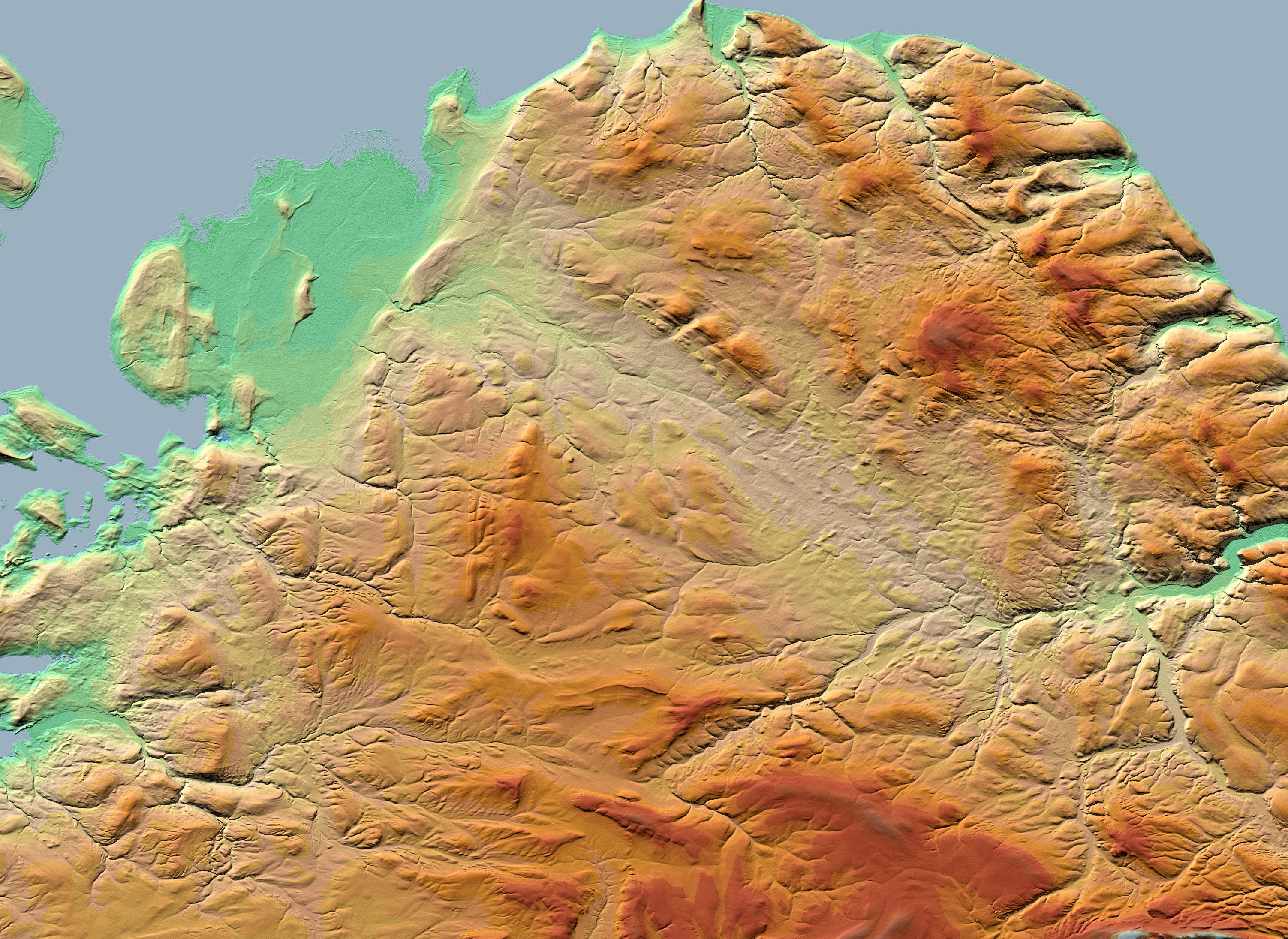
TanDEM-X conditioned digital elevation model and HydroSHEDS v2 preliminary river network for Iceland

Next generation of HydroSHEDS: replacing SRTM elevation model with DLR products

DLR's twin TanDEM-X and TerraSAR-X satellites. Image credit: ©DLR. Learn more about the TanDEM-X mission.

Today, the TanDEM-X dataset, created in partnership between the German Aerospace Agency (DLR) and Airbus, offers a new digital elevation model covering the entire global land surface including northern latitudes. In a collaborative project, this dataset is used to extract HydroSHEDS v2 following the same basic specifications as version 1.

DLR is processing the original 12 m resolution TanDEM-X data to create a hydrologically pre-conditioned version at 1 arc-second resolution. In this step, corrections with high-resolution vegetation and settlement maps are applied to reduce distortions caused by vegetation cover and in built-up areas. Following this preprocessing, refined hydrological optimization and correction algorithms are used to derive the drainage pathways, including improved ‘stream-burning’ techniques that incorporate recent data products such as high- resolution terrestrial open water masks and improved tracing of drainage pathways as centerlines in global lake and river maps.

The resulting HydroSHEDS v2 database will provide river networks and catchment boundaries at full global coverage. Release of the data under a free license will begin in 2024.

High-resolution elevation from Tandem-X

View images of TanDEM-X elevation data at the native 12m resolution.

Comparison to other river networks

The images below depict river network delineations for a region in Iceland.

The HydroSHEDS v1 network depicted in the figure below (in regions north of 60N) is derived from the coarser resolution HYDRO1k elevation data and produced at 15 arc-second (~500 m). In northern regions there is no underlying SRTM data, meaning that these regions are of lower quality compared to the global product. MERIT Hydro is derived from SRTM3 and AW3D, and produced at 3 arc-second (~90 m) resolution. HydroSHEDS v2 is derived from TanDEM-X elevation data, and produced at 1 arc-second (~30 m) resolution.

Due to the differing resolutions of production, the HydroSHEDS v1 network has a lower river density compared to the MERIT Hydro and HydroSHEDS v2 river networks.

HydroSHEDS v1.0 HydroSHEDS v2.0
The left image depicts the HydroSHEDS v1 river network (produced in northern regions from coarser HYDRO1k elevation data) and the right image depicts the HydroSHEDS v2 preliminary river network (produced at 90 m resolution). Slide to compare the two river networks.
MERIT Hydro HydroSHEDS v2.0
The left image depicts the MERIT Hydro river network and the right image depicts the HydroSHEDS v2 preliminary river network (both produced at 90 m resolution). Slide to compare the two river networks.
By clicking “Accept All Cookies”, you agree to the storing of cookies on your device to enhance site navigation, analyze site usage, and assist in our marketing efforts. View our Privacy Policy for more information.